


AI for AZ: ABOR funds new tools for state emergency response
Paulo Shakarian leads ASU team developing artificial intelligence to help Arizona DEMA secure the state’s future

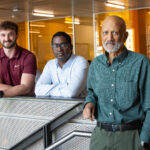
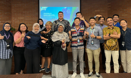
A team of Arizona State University researchers poses for a photo on the ASU Tempe campus. From left to right: WenWen Li, a professor of geographic information science in ASU’s School of Geographical Sciences and Urban Planning; Ted Senator, a distinguished member of the research staff in ASU Research Enterprise; Paulo Shakarian, an associate professor of computer science and engineering in the School of Computing and Augmented Intelligence, part of the Ira A. Fulton Schools of Engineering at ASU; and YooJung Choi and Hua Wei, both Fulton Schools assistant professors of computer science and engineering. The team will work together to create emergency management tools powered by artificial intelligence. Photographer: Erika Gronek/ASU
A huge wildfire rages in the wilderness of Arizona’s White Mountains. The blaze scorches asphalt and damages area bridges, causing traffic accidents when residents attempt to evacuate. As hospitals are flooded with patients, power lines succumb to the flames, leaving doctors working in the dark. Later, farmers in the state discover smoke damage to crops, sending food prices soaring.
This hypothetical scenario is an example of a cascading disaster — when an unexpected event occurs and triggers a series of calamities.
Now, the Arizona Board of Regents, or ABOR, has taken an important step in helping the state improve its readiness to face such scenarios. This month, the governing body for Arizona’s public universities awarded a $1.7 million research grant to the Department of Emergency and Military Affairs, or DEMA. As part of the grant, a team of experts at Arizona State University will develop software powered by artificial intelligence, or AI, to assist emergency responders in predicting and managing disaster scenarios.
The project is led by Maj. Gen. Kerry Muehlenbeck, director of DEMA and adjutant general of Arizona. Paulo Shakarian, an associate professor of computer science and engineering in the School of Computing and Augmented Intelligence, part of the Ira A. Fulton Schools of Engineering at ASU, is overseeing the work being done at the university.
Shakarian is a leading voice in the field of neurosymbolic AI, the scientific push to create forms of artificial intelligence that are trustworthy and produce reliable results. As a former commissioned officer in the U.S. Army and recipient of the Bronze Star, he brings a distinct perspective to the work.
Shakarian explains that the project will apply several ideas from the field of AI, including logic programming and machine learning, where computers process huge sets of data about the past to calculate the probability of future events while authenticating the predictions. The results of this analysis will be used to create algorithms, or instructions the software uses to do its work. The end goal is to help emergency planners have the right resources in the right place at the right time.
“Second and third-order effects, or the mid and long-term consequences of disasters, are very difficult to account for when you do emergency management planning,” Shakarian says. “One of the important ideas here is that the algorithms need to anticipate these effects so that state planners can pre-position assets to get ahead of problems that can arise.”
The A team for AI
The project has several phases.
First, the team will identify and analyze the root causes of past disasters and emergencies.
They will then move on to disaster prediction, creating the AI that will model both initial disasters and the events that can cascade from them. The team’s focus during this phase will be on the development of clear visuals and scenario explanations that are useful to responders.
The third phase will be driven by the question, “What if?” It seeks to create tools that show emergency managers the effects of the decisions they might make. What if firefighters are sent to one town and a wildfire breaks out in another? What will happen if a heat wave lasts 30 days? What about 40?
Throughout all the phases, the team will engineer software that can be used directly at DEMA.
For the work, Shakarian assembled an interdisciplinary team that includes Hua Wei and YooJung Choi.
The pair of computer science and engineering assistant professors bring considerable expertise in the creation of AI systems. Wei will expand on current research he is conducting for the U.S. National Science Foundation, or NSF, where he developed traffic flow and epidemic control algorithms. Choi, known for her co-discovery of a novel form of AI called probabilistic circuits, will focus on the predictive aspects of the program.
They are joined by retired U.S. Army Lt. Gen. Benjamin Freakley and former Assistant Secretary of the U.S. Air Force Tidal McCoy. Together, they will form the project’s advisory board.
Ross Maciejewski, director of the School of Computing and Augmented Intelligence, says the grant reflects the excellence of ASU faculty and its collaborative capabilities.
“We’re honored to be a part of this partnership,” Maciejewski says. “This team exemplifies our dedication to advancing transformative research in ways that benefit our communities and our state.”

A display of information about Hurricane Harvey generated by GeoGraphVis, software developed using Li’s geospatial insights. The illustration shows the location of people affected by the 2017 storm who did not have health insurance and might therefore require additional assistance. Illustration courtesy of WenWen Li/ASU
Where geography comes in
For emergency responders to be prepared for what is likely to happen, they must also understand where disasters are likely to occur.
To help understand this, the team has tapped WenWen Li.
Li is a professor of geographic information science in ASU’s School of Geographical Sciences and Urban Planning. She is a past winner of an NSF Faculty Early Career Development (CAREER) Award and has conducted research for NASA and the U.S. National Institutes of Health.
As an expert in combining geospatial data, or complex information about locations on the Earth’s surface, with AI, Li helps make sense of where events are happening or will happen in the future.
She says location and geographical insights are essential for emergency management and planning.
“Besides understanding the atmospheric conditions like extreme weather and all the related geophysical information, emergency managers also need to know where vulnerable communities are located to ensure health concerns are addressed,” Li says. “We can use geography to integrate socioeconomic, infrastructure and health data to provide location-based analysis with AI.”
For the ABOR-funded project, she will build on her experience developing cyberinfrastructure tools such as GeoGraphVis to support disaster management and sustained geospatial innovation.
Li will combine the functionality of such tools with AI-based insights to produce visual models of disaster scenarios as they might unfold across both space and time, providing invaluable decision-making information to users.
Delivering solutions to DEMA
To ensure that the project delivers the most helpful tools to DEMA, the team turned to Ted Senator.
Senator is a distinguished member of the research staff in ASU Research Enterprise, or ASURE. In that role, he serves as a liaison between DEMA and the ASU team, working to ensure successful collaboration.
“DEMA needs advanced capabilities to more accurately understand what’s going on in any sort of emergency, and then to come up with appropriate mitigations and responses,” he says. “In order to do that, we want to bring the most advanced technology that ASU has to offer.”
Senator is a past program manager for the U.S. Defense Advanced Research Projects Agency with a track record of leading teams through the development and deployment of large-scale AI systems. He’ll apply that experience to this project, interfacing with DEMA to create new software that integrates with their existing systems.
He says he believes that the investment will pay off for Arizona residents.
“DEMA has mission-critical needs,” Senator says. “For them to be able to respond more effectively and quickly examine a larger range of alternative emergency responses, benefits the population of Arizona.”
Shakarian agrees and sees the work as an example of how research can benefit local communities.
“The key thing here is that this work is going to directly impact the state,” Shakarian says. “This grant is about giving the public access to the innovative outcomes of the research produced by Arizona-based universities.”


